Beside the house
The Quay
Beside Island House, archaeologists uncovered the first medieval quay ever excavated in Wales — first built in the twelfth or thirteenth century.
Beside the house
Beside Island House, archaeologists uncovered the first medieval quay ever excavated in Wales — first built in the twelfth or thirteenth century.
Home › The History › The Quay
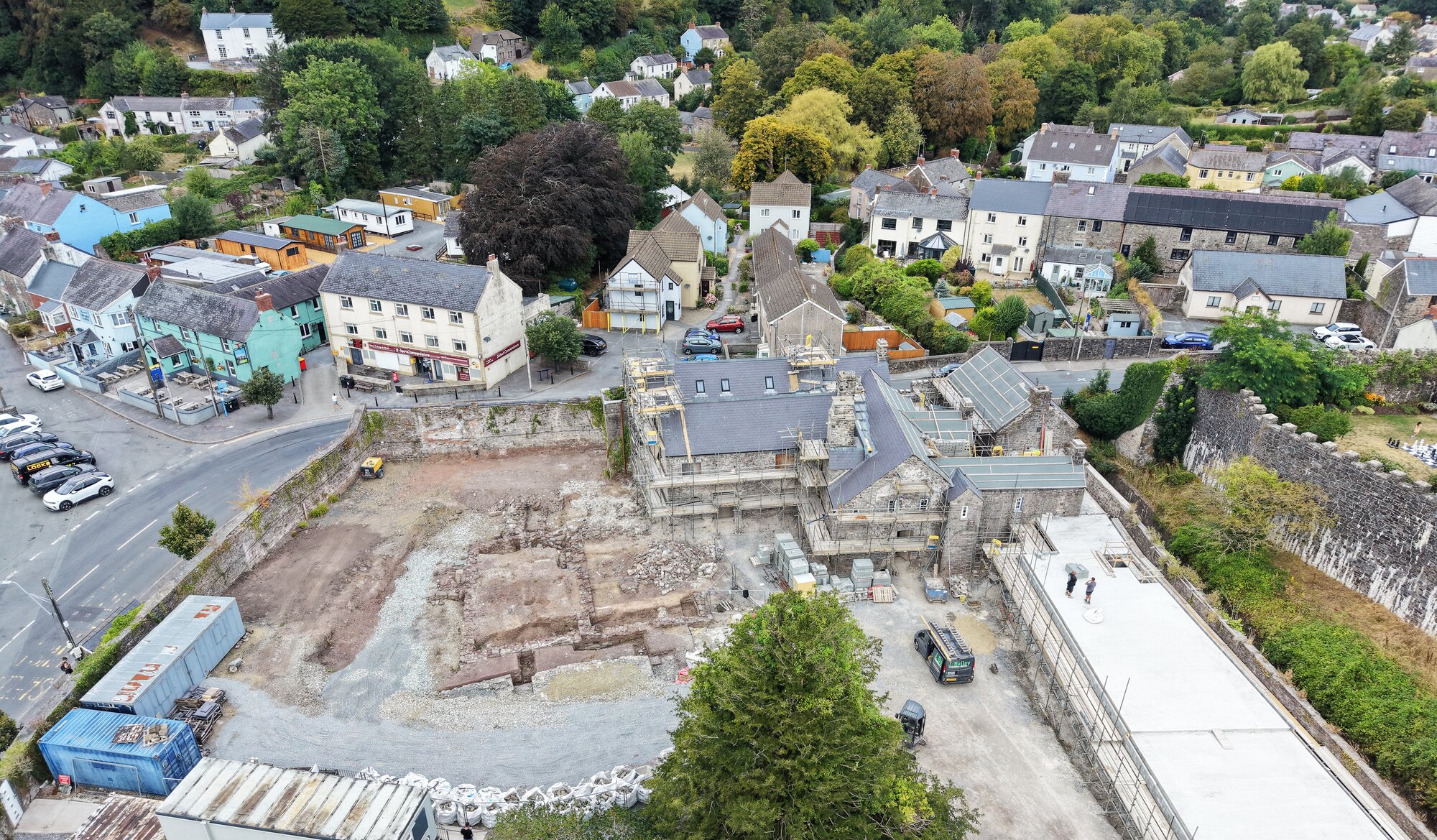
Stand in the garden of Island House at low tide and you are standing on a waterfront. The house sits at the edge of the old town of Laugharne, on the gravelly ground where the little Coran stream once met the tide, just outside the medieval walls and in the shadow of the castle. For centuries this was not a garden at all but a working edge of the sea — a place where the estuary reached in, and where boats could come alongside.
That is no longer a guess. Between the 2020 season and the recent digs — commissioned by Island House Restoration Ltd and supervised by Ken Murphy for Heneb, the Trust for Welsh Archaeology (formerly the Dyfed Archaeological Trust) — the trenches beside the house gave up the waterfront itself. The archaeologists found a stone quay first built in the twelfth or thirteenth century, set on a tidal inlet outside the town walls; as that inlet silted, later quays were built further out, so the ground reads as a sequence of shorelines retreating from the house across the medieval centuries. This is the find that carries a genuine national first: the first medieval quay to be archaeologically excavated in Wales.
The quay did not stand alone. The same ground held a large, high-status medieval hall house — a hall open to its roof, with a central fireplace and the smoke finding its way out high above. In the 2020 season the diggers traced a watercourse that the town and castle had used as a midden from the twelfth century, its layers left undisturbed. And among the finds came the imported pottery — the clearest proof of reach. Ceramics that began life in Bristol, on the French coast, and further south still speak of a household plugged into long-distance trade.
Here honesty earns the story its weight. That pottery tells us where goods came from, not how they travelled. The evidence points to continental wares reaching this creek largely through Bristol — the great English entrepôt just across the water — with, at most, a small direct run to France and no sign of ships sailing in from Iberia. The everyday cargoes of such a Taf-estuary creek were the plain ones: grain, oats, coal and stone. Set beside the Georgian house that later served the marine trade under the Skyrme chandlers, the picture holds at both ends — a medieval trading quay, and centuries on a marine-supply house on the same plot. One waterfront, two ages.
Drawn from the evidence
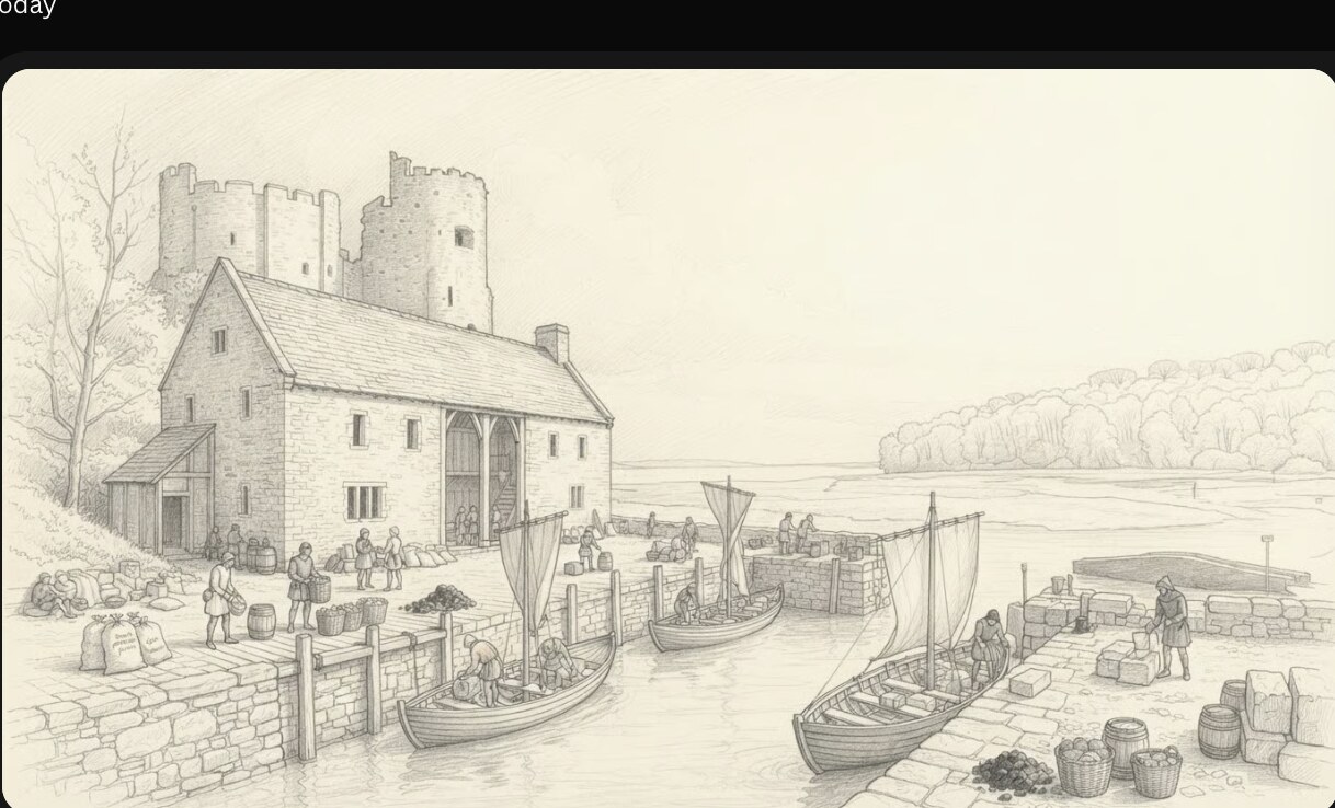
The waterfront in use — the quays, the hall house and the tidal inlet are evidenced by the excavation, and the trade is that of a modest Bristol-Channel creek. The boats, figures and cargo are informed reconstruction, drawn onto the real castle-and-creek geography; the dating is provisional.
An evidence-based reconstruction drawing, not a photograph. No photograph of the medieval scene exists — only the geography is real. The structure follows the archaeology and the building record; the people, boats and cargo are informed reconstruction. Where the record is silent we have said so.
One plot, across the ages
Five drawings of the same piece of ground, five centuries apart — the waterfront, the sub-medieval house, the Picturesque dressing, the Victorian garden, and the house as it stands today under restoration.
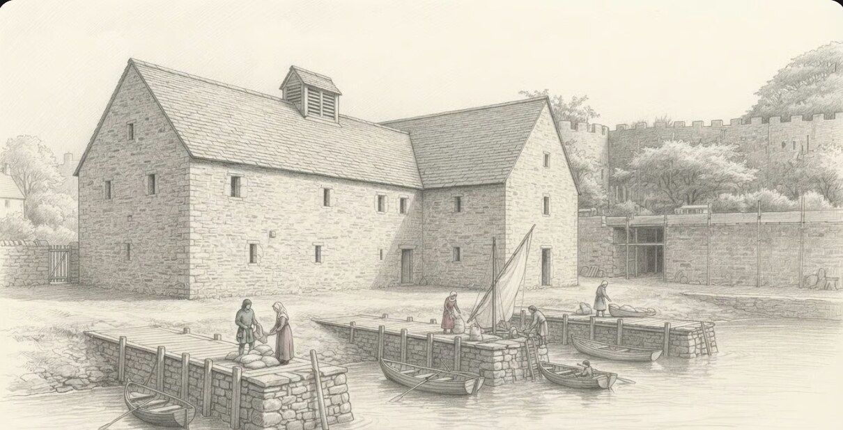
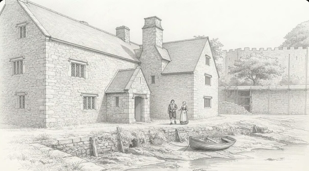
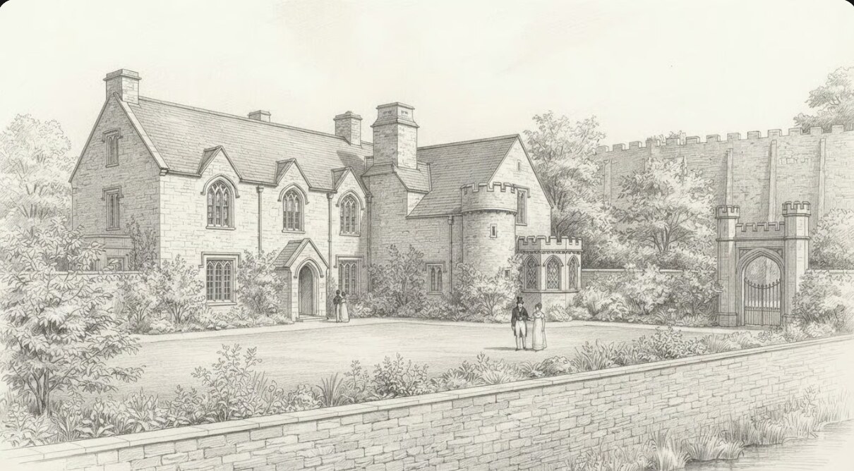
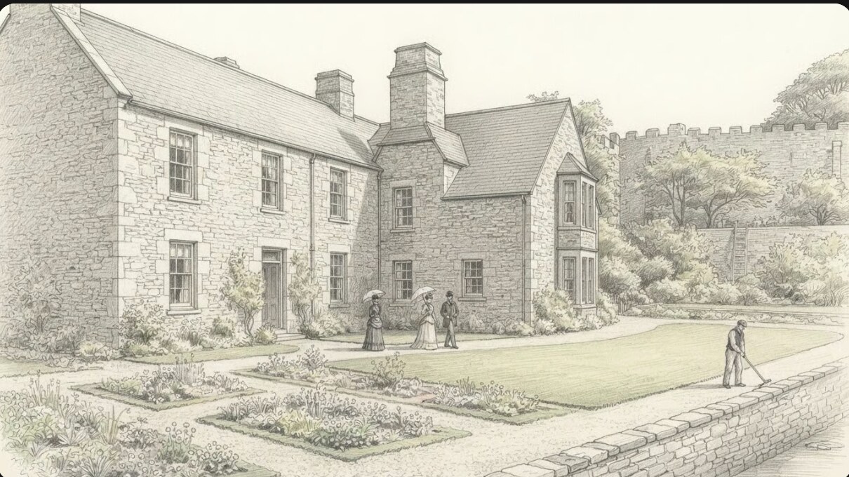
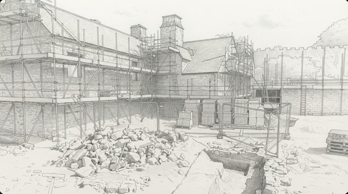
These are evidence-based reconstruction drawings, not photographs. Solid lines follow the archaeological and documentary record; the people, boats, planting and other soft detail are informed reconstruction. Where the record is silent we have said so. The medieval dating is provisional pending scientific dates.
Drawn from the evidence
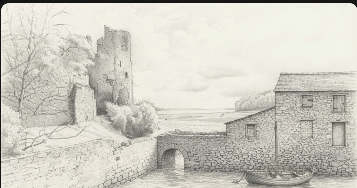
The waterside range — the estuary-cobble walling against the castle (F11), the boarded and blocked waterside openings (F17), the creek and leat boundary walls (F21) and the external mullions (F15/F16) are evidenced. This is the ground where the three burgage quays were excavated — thirteenth to fourteenth century, on de Brian burgages, a modest Bristol-Channel tidal creek rather than a grand port; the dating is provisional. Water level, boats and figures are informed.
An evidence-based reconstruction drawing, not a photograph. The structure follows Island House’s surviving fabric (the building record) and the archaeology; the fire, furnishings, figures, boats and planting are informed reconstruction. Where the record is silent we have said so.
One of six drawings made for The Rooms, As They Were, where it sits beside a photograph of the creek wall as it stands today.
Where the evidence stands
Solid, and publishable as fact: the excavated quay, the hall house, the stratified midden and the imported pottery — all from the excavator's own record.
Genuinely contested: the scale. To call this a busy port, or the principal quay of the Taf, goes beyond the evidence — a reading questioned in recent work (Brewer, 2023), and complicated by at least two other named landings on the same estuary, the “Old Wharf” by the ferry and Fern Hill’s “Old Quay.” The discovery is real; its primacy in traffic is not settled.
And kept clearly as tradition, not fact: the old tale that ships from Virginia once landed tobacco here — a single, self-hedged memory recorded by Mary Curtis in 1880 — along with the lore of the sea-steps and the lost bridges.
A note on the house’s own timbers: a roof beam has been dated by dendrochronology to 1437, but that is an earlier phase, not the building’s birthday — the standing front range has been re-dated to the 1650s–70s by RCAHMW’s isotopic work. The formal excavation report and finds catalogue are still to be published; when they come, this account should be read against them.
Researched 2026 from primary and archaeological sources. The formal Heneb excavation report and finds catalogue are awaited.